


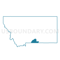
Precinct 16, Carbon County, Montana
About
Outline

Summary
| Unique Area Identifier | 611852 |
| Name | Precinct 16 |
| County | Carbon County |
| State | Montana |
| Area (square miles) | 188.06 |
| Land Area (square miles) | 188.06 |
| Water Area (square miles) | 0.00 |
| % of Land Area | 100.00 |
| % of Water Area | 0.00 |
| Latitude of the Internal Point | 45.29957490 |
| Longtitude of the Internal Point | -109.39438200 |
Maps


Graphs
Select a template below for downloading or customizing gragh for Precinct 16, Carbon County, Montana


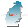
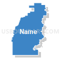

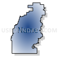

Neighbors
Neighoring Voting District (by Name) Neighboring Voting District on the Map
- Precinct 1, Stillwater County, MT
- Precinct 11, Carbon County, MT
- Precinct 13, Stillwater County, MT
- Precinct 13, Carbon County, MT
- Precinct 7, Carbon County, MT
Top 10 Neighboring County Subdivision (by Population) Neighboring County Subdivision on the Map
- Red Lodge CCD, Carbon County, MT (3,995)
- Columbus CCD, Stillwater County, MT (3,797)
- Roberts CCD, Carbon County, MT (1,129)
Top 10 Neighboring Elementary School District (by Population) Neighboring Elementary School District on the Map
- Columbus Elementary School District, MT (3,625)
- Red Lodge Elementary School District, MT (3,300)
- Absarokee Elementary School District, MT (1,865)
- Luther Elementary School District, MT (395)
Top 10 Neighboring Secondary School District (by Population) Neighboring Secondary School District on the Map
- Red Lodge High School District, MT (3,828)
- Columbus High School District, MT (3,825)
- Absarokee High School District, MT (2,302)